Class Location and High Consequence Area Analysis
Powering over 300,000 households and businesses across New York and New Jersey, Orange & Rockland sought to address class locations and high-consequence areas for high-pressure gas pipelines and facilities.
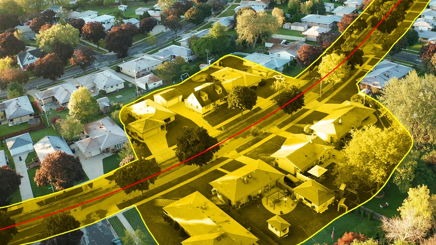
CHA utilized aerial imagery to identify structures within a specified buffer encompassing pipelines and facilities. Our skilled field crews were mobilized to verify intricate scenarios ranging from new construction to unidentifiable structures and densely populated areas. Verified data was then processed using the Intrepid® software, enabling advanced analysis. By combining aerial assessment, on-site validation, and software processing, potential risks were discerned and effectively mitigated, and a summary report for the Class Locations and High Consequence Area study was developed.
Project summary
Supplying power to over 300,000 customers.
Two data collection methods: aerial and on-site validation.
Talk to an expert

Neal O'Driscoll
Senior Vice President,
Digital Solutions
Neal has three decades of experience managing and delivering geospatial solutions to energy, transportation and municipal clients. He actively contributes to the firm’s significant oil and gas projects, driving the company toward new opportunities by introducing innovative geospatial services to clients. His expertise includes technology assessments, functional requirements and application specifications definitions, system interface definition, software configuration, data conversion/migration, and system deployment.